 BGS Data Catalogue
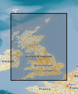
Marine gravity surveys
Type of resources
Topics
Keywords
Contact for the resource
Provided by
Years
Formats
Update frequencies
Scale
-
This layer of the map based index (GeoIndex) shows the location of land and marine gravity observations on the UK mainland, Northern Ireland, offshore islands, tidal estuaries and seabed. Most of the surveys were carried out by the BGS but the database includes data originally acquired by other organisations and subsequently given to the BGS to be managed as part of the national archive. Complete coverage of the UK mainland with a station density of 1-2 stations per square kilometre. Unadjusted ship gravity, magnetic and bathymetry data acquired by BGS as part of its Offshore Reconnaisance Mapping Programme. Unadjusted ship gravity, magnetic and bathymetry data acquired by BGS as part of its Offshore Reconnaisance Mapping Programme. This programme commenced in 1967, and was funded mainly by the Department of Energy. Marine gravity readings are from unadjusted ship gravity and bathymetry data from various commercial and academic surveys between 1965 and 1994. Confidential M.O.D Hydrographic Office integrated ship gravity and magnetics surveys of NW Europe marine areas for which BGS acts as agent. Network adjusted gravity and magnetic compilations of data from BGS and non-BGS sources.
-
This dataset is the complete collection of the British Geological Survey (BGS) held Marine Survey data. The data held includes digital data and analogue records, plus associated physical sample material. Data are stored within the National Geosciences Data Centre (NGDC) and the Marine Environmental Data and Information Network (MEDIN) Data Archive Centre (DAC) for Geology and Geophysics. BGS have collected Marine Survey data since 1966 and have also been provided with a range of third-party data. The data includes geophysical data (seismic reflection, side-scan sonar, multibeam echosounder bathymetry and backscatter, gravity and magnetics) and sample data from boreholes, cores and seabed grabs (logs, geological descriptions, geochemical, particle size analysis and geotechnical data). The majority of surveys are within the United Kingdom Continental Shelf (UKCS) area. Individual survey data coverage varies, depending on survey type (sampling, geophysics, multibeam or multi-disciplinary) and objectives (regional or local, shallow or deep). These data are applicable to a wide range of uses including environmental, geotechnical, geophysical and geological studies. Data are delivered via the BGS Offshore GeoIndex www.bgs.ac.uk/GeoIndex/offshore.htm. Additional data are available on request enquiries@bgs.ac.uk.
-
The Marine Aggregate Levy Sustainability Fund (MALSF) commissioned a series of Regional Environmental Characterisation (REC) surveys via the Marine Environment Protection Fund (MEPF) to develop understanding of submerged habitats and heritage in Britain. The aim was to acquire high quality data to enable broad scale characterisation of the seabed habitats, their biological communities and potential historic environment assets. The surveys were conducted in the following areas - Outer Bristol Chanel (2003 – 2005), Eastern English Channel (2005 – 2006), South Coast (2007 - 2010), Outer Thames (2007), East Coast (2008 - 2009), Humber (2008 - 2009). The Geology and Geophysics component of the data are archived by British Geological Survey (BGS) in the Marine Environmental data and Information Network (MEDIN) Data Archive Centre (DAC) for Geology and Geophysics. The data includes bathymetry, sidescan sonar, sub-bottom profiler, magnetometer, seabed video and photographs, Particle Size Analysis (PSA) data, vibrocore (logs and images). Data are delivered via the BGS Offshore GeoIndex www.bgs.ac.uk/GeoIndex/offshore.htm. Additional data are available on request enquiries@bgs.ac.uk. Other data types have been archived with the other MEDIN DACs as appropriate (UKHO DAC for bathymetry data and DASSH DAC for biological data). The MALSF ceased operation at the end of March 2011 (http://www.marinealsf.org.uk/).